Waterborne GPR Experiment
Motivation and Objective
Underwater mapping is traditionally performed using sonar systems for bathymetric surveys and sub-bottom profilers for imaging subsurface stratigraphy. An alternative method for underwater mapping involves using ground penetrating radar (GPR). Limited research has been conducted with this approach because of the attenuation of electromagnetic waves in water, reducing the capability. However, if proven effective in certain conditions, this method would provide higher resolution multi-parameter imaging and allow for data collection in less accessible areas. This project aims to determine the feasibility and effectiveness of untilizing ground penetrating radar paired with an autonomous surface vehicle in shallow water environments. The project required a thorough understanding of electromagnetic wave propagation in water, GPR system operation, and data processing techniques.
Approach
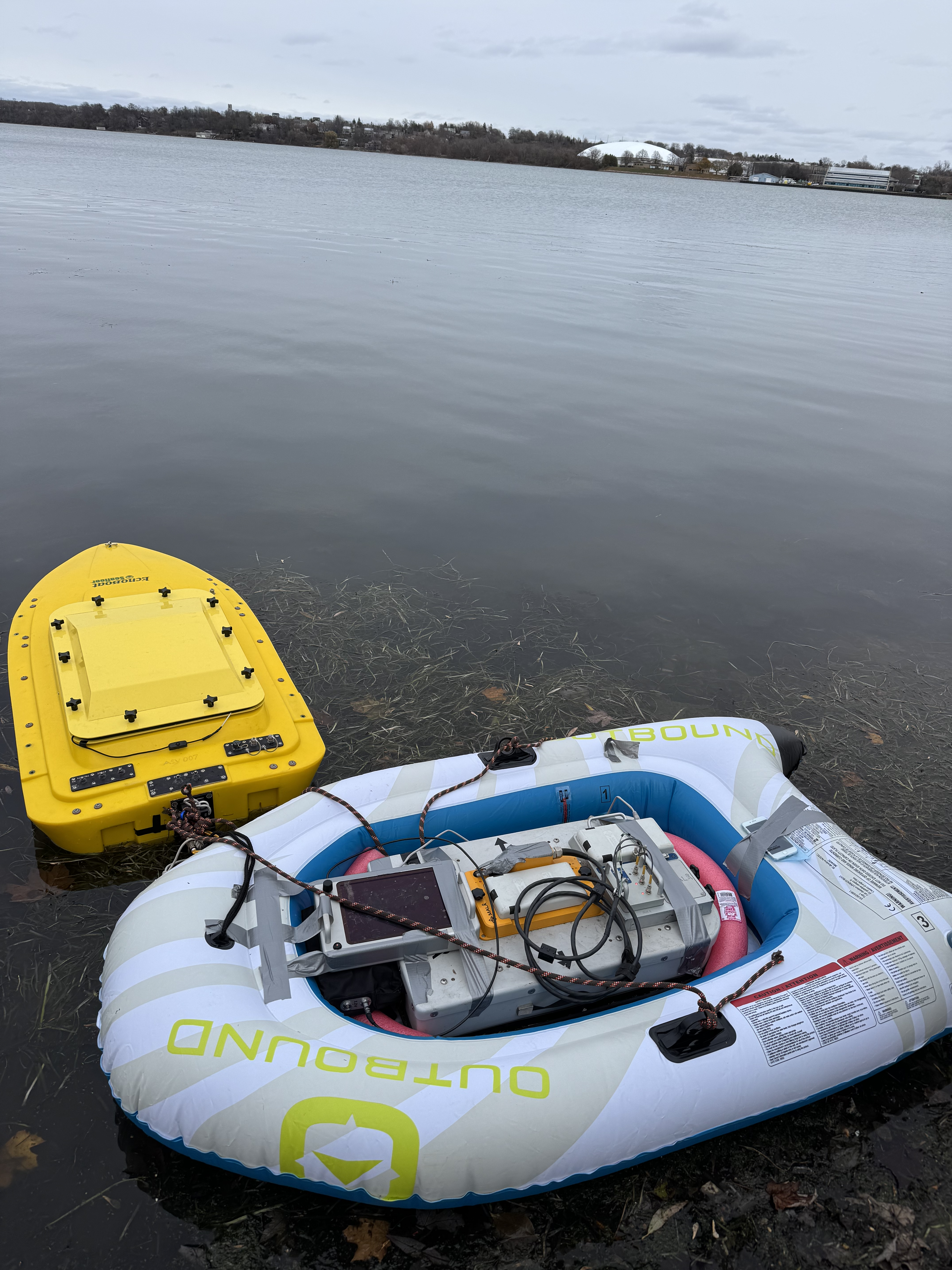
The GPR system was the MALA ProEx GPR equipped with a 250MHz antenna. The GPR was placed on a floatation device with minimal air between the antenna and the water to minimize signal loss due to reflections. The floatation device was then attached to the autonomous surface vehicle (ASV) via a rope system and the ASV was controlled with a handheld remote. MalaVision was used to process the GPR data and multiple filters were applied to generate suitable radargrams for interpretation. Through analysis of the data collected it was clear that waterborne GPR can be effective in shallow water environments. The rough bathymetry of the area was successfully mapped and several subsurface features were identified. Further details are included in the report.
View Report (PDF)